Daily Earth View
Our planet, seen whole — every day.
About
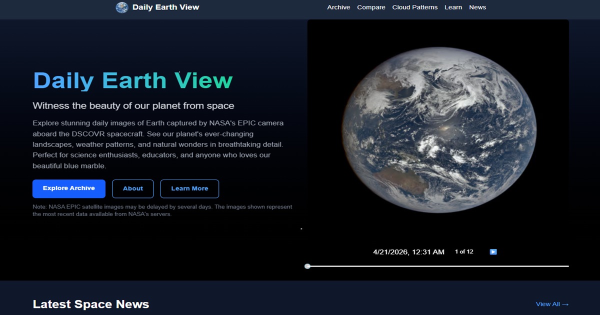
Daily Earth View is a web application that surfaces NASA's EPIC (Earth Polychromatic Imaging Camera) satellite imagery in an engaging, accessible format. Every day the site fetches the latest full-disk Earth images captured by the DSCOVR spacecraft at the L1 Lagrange point, then presents them in an interactive timeline so visitors can watch clouds shift and continents rotate across 24 hours. Beyond the daily view, users can browse a historical archive dating back to 2015, compare images side-by-side across dates, explore educational articles on climate science and Earth observation, and read curated space-news headlines. The site is designed for scientists, educators, students, and anyone curious about Earth from a planetary perspective.
Key Features
- Daily full-disk Earth images sourced automatically from the NASA EPIC API
- Interactive timestamp slider to scrub through multiple captures per day
- Historical archive browser covering every available date back to 2015
- Side-by-side date comparison tool for visualising change over time
- Educational Learn section covering EPIC science, Earth's rotation, cloud dynamics, climate change, and more
- Curated space-news feed with individual article pages
- Did You Know? fact widget for bite-sized Earth science snippets
- Fully responsive, dark-themed UI optimised for desktop and mobile
- SEO-optimised pages with Open Graph and Twitter Card metadata
Ready to explore?
Open Daily Earth View